 |
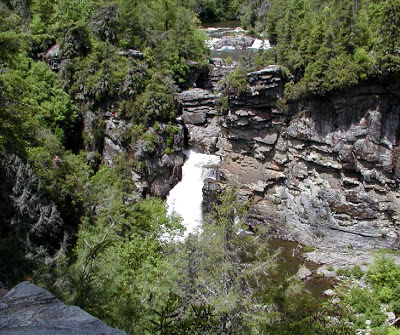
| Linville Falls from the Chimney View Overlook |
One of the most breathtaking waterfalls in our neck of the woods is Linville Falls, less than an hour from the Inn on Mill Creek. Linville Falls is actually a set of waterfalls: two small “upper falls” move the Linville River into a small canyon, where the water rapidly twists and turns downhill through the rocks, then dramatically plunges 45 feet {the lower falls}. The sheer volume of water really makes the lower falls a spectacular waterfall.
The next overlook is about two-tenths of a mile further up the trail and is called the Chimney View {as seen in the photo at the top of this blog post}. The overlook gets this name because the columns of rock next to the falls look like — you guessed it — chimneys.
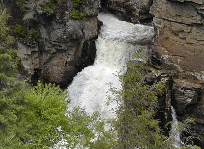 |
| That’s a lot of water |
A well-maintained 1.6-mile roundtrip trail called the Erwin’s View Trail heads out from the Linville Falls Visitor Center. The trail meanders through woods full of rhododendron,
oaks, ancient hemlocks and pines and along the Linville River, and
includes four overlooks, where you can see the falls from different
vantage points.
|
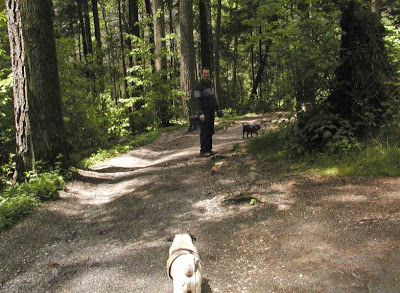
The innpugs give the Erwin’s View Trail two paws up
|
The first overlook is about a half-mile down the trail. Looking in
one direction, you see the picturesque and relatively calm upper falls:
|
|
|
The upper falls from the first overlook along Erwin’s View Trail
|
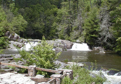
Turning around, you see the river twisting around the rocks through the canyon:
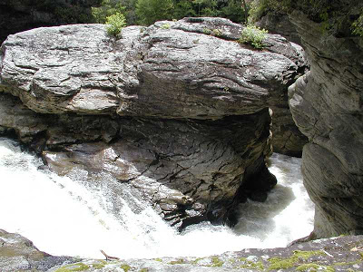 |
| Seriously swirling torrent of temerity |
The next overlook is about two-tenths of a mile further up the trail and is called the Chimney View {as seen in the photo at the top of this blog post}. The overlook gets this name because the columns of rock next to the falls look like — you guessed it — chimneys.
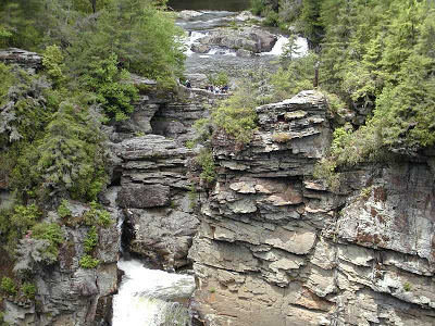 |
| The “chimneys”…see the tiny people at the upper falls overlook? |
This part of the trail is more moderate than the first half and does
have some elevation gain, with rocks on the trail and stairs made of
rock. Another two tenths of a mile brings you to the end of the trail at Erwin’s View Overlook {actually two overlooks here}, with a more distant view of the falls and the surrounding Linville Gorge Wilderness Area.
have some elevation gain, with rocks on the trail and stairs made of
rock. Another two tenths of a mile brings you to the end of the trail at Erwin’s View Overlook {actually two overlooks here}, with a more distant view of the falls and the surrounding Linville Gorge Wilderness Area.
Two, more strenuous, trails also lead from the Linville Falls Visitor Center and give you up-close views of the lower falls plunge basin. Since we had the “don’t make us get our
feet wet” innpugs with us this day, we stuck to the easier trail;
however, you can find a great description with photos at www.ncwaterfalls.com/lin2.htm.
feet wet” innpugs with us this day, we stuck to the easier trail;
however, you can find a great description with photos at www.ncwaterfalls.com/lin2.htm.
The easiest route to Linville Falls from our Bed & Breakfast is to take Hwy 70 east through Old Fort, then Hwy 221 north to the Blue Ridge Parkway, a scenic drive with the lovely North Carolina mountains as a backdrop. You’ll pass by the Linville Falls Mountain Club and Preserve, which features a 18-hole public golf course designed by Lee Trevino. Beyond that is Linville Caverns, and then you reach the Blue Ridge Parkway. Turn right {north} on the Parkway and head about a mile to Linville Falls Road, turn right, and watch for signs for the Visitor Center, which is run by the National Park Service. You’ll find a parking area for hiking trails at the Visitor Center.
Things we learned about the Linville area: The headwaters of the Linville River are located at Grandfather Mountain {another awesome place to visit while you’re staying at the Inn on Mill Creek}, and the river runs south through the Linville Gorge Wildnerness Area, down Linville Falls, and on to Lake James in Marion, NC. The Linville area is named for the frontier explorer Captain William Linville, and his son, John, who were killed at the falls in 1766 by a rogue band of Native Americans who were enemies of the Cherokee and white settlers.


